My photos in Google Earth

My photos in Google Maps

A few weeks ago I wrote about using Panoramio to publish and view images from around the world in Google Earth and Google Maps. At the time I posted just a single beach scene from Hamilton Island in Australia as a test image and noted that it takes a while for these images to appear to any user of Google Earth. At long last these have now appeared!

After I wrote the article I added a few more images I had lying around. After a few weeks, they started being flagged by the Panoramio reviewers as having been accepted by Google Earth.

Continue reading

Panoramio – See your photos in Google Earth

Panoramia overlay in Google Earth

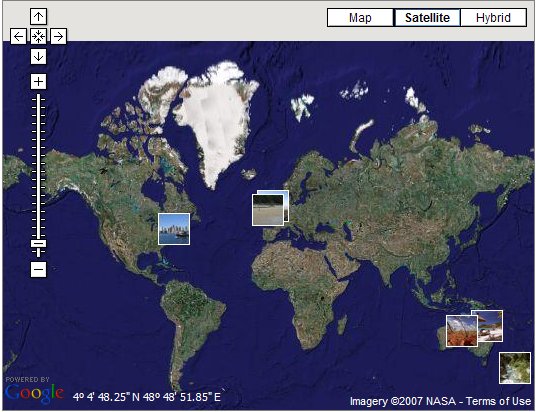
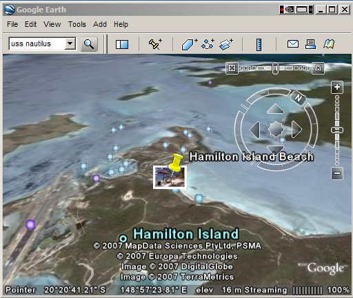
Something I came across recently was the ability to share your own photos of places around the globe using Google Earth. A Spanish company called Panoramio have created a very easy way of selecting locations on the globe and adding your own pictures. Other users of Google Earth can then see these photos by clicking on the camera symbols that get overlaid onto the map.

At first sight Panoramio looks just like yet another website that hosts online galleries. You can store upto 2Gb of pictures for free. Other users of the site can browse your pictures. But the big difference here is that you can do this by clicking on a Google Map window, and have the images appear to other people via Google Earth. A two way link between an image browser list and the map window means selecting an image in either window will select it in the other so you can see in a very dynamic way where pictures were taken. It is much easier to try than describe – go to the Panoramio Map and have a play.

And then the really smart thing is link into 3D with Google Earth. Read on…
Continue reading

Plotting your GPS tracks in Google Earth

Google Earth

As a follow up to my previous post about using Google Maps in conjunction with your own GPS data, you can also do the same thing in Google Earth. Something I missed before was that the same GPSVisualizer site provides the service so that you upload your GPS file, and it generates a Google KMZ file for you. Click on it, and the file gets downloaded and launched in Google Earth directly. Very neat and very easy. Here’s a screenshot:
Continue reading