
A few weeks ago I wrote about using Panoramio to publish and view images from around the world in Google Earth and Google Maps. At the time I posted just a single beach scene from Hamilton Island in Australia as a test image and noted that it takes a while for these images to appear to any user of Google Earth. At long last these have now appeared!
After I wrote the article I added a few more images I had lying around. After a few weeks, they started being flagged by the Panoramio reviewers as having been accepted by Google Earth.
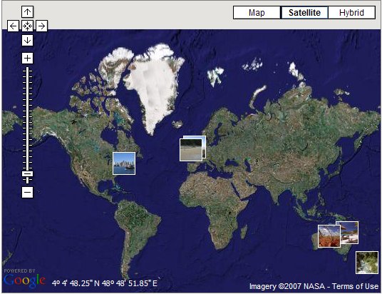
However, when I looked at Google Earth I found that not all of the pictures were there. But a quick look at Google Maps showed that they were all present for anyone on the web to look at:
There appears to be a lag of around a couple of weeks between the image being flagged in Panoramio as being accepted and it appearing to other users of Google Earth despite it appearing in Google Maps much sooner. While I still really like Panoramio and will continue to add photos to it, I must admit to being frustrated by the long wait between submission and publishing of images. For my beach image it was a period of nearly two months, which I think will put a lot of people off.
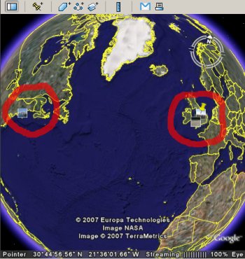
Despite this there is a bit of a thrill in seeing your own photos in Google Earth. I’ve taken a screen shot to show the images as they appear from the Panoramio link. Since I can only see one side of the globe only a few images are visible – I’ve ringed them in red. Although looking at the image again, perhaps I should have drawn a nose somewhere mid-Atlantic and a smile somewhere near Ascension Island!
One improvement I would like to see is an optional email notification when an image has been accepted, and again when it is available in the various online applications.